Morganton Location
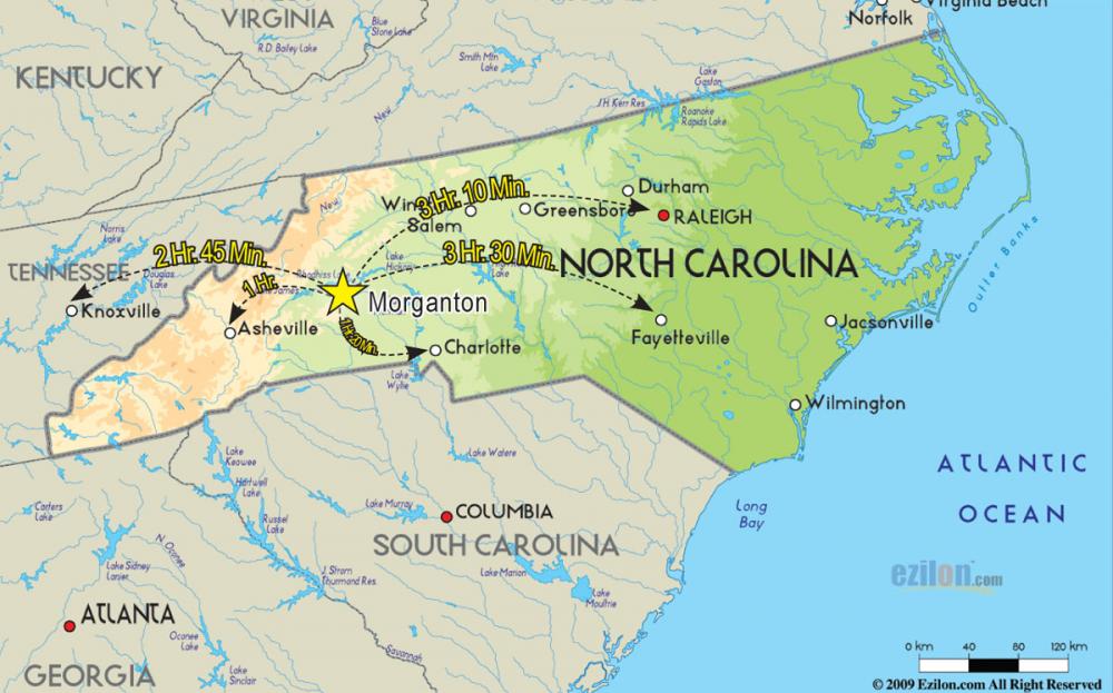
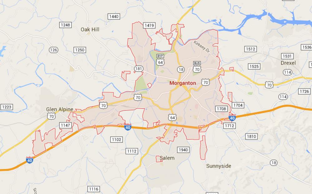
Morganton covers 18.55 square miles. Interstate 40 runs through the City and five interstate exits are located in the city limits: Exits 98, 100, 103, 104, and 105. In addition to I-40, U.S. Highways 64 and 70 and NC highways 18 and 181 intersect the City's corporate limits at various points. I-85, I-77 and I-26 are within 50 miles of the City.
Southern Railway services Morganton and Burke County by rail and approximately 30 major truck carriers provide ground/freight transportation.
Charlotte and Asheville are about an hour’s drive away. Charlotte's Douglas International Airport is approximately 70 miles from Morganton and offers about 500 flights per day. General aviation and charter services, as well as housing for numerous corporate and private aircraft are available at the Foothills Regional Airport approximately eight miles northeast of Morganton. This facility is a joint venture between the City of Morganton, Burke County, the City of Lenoir and Caldwell County.
Contact Information
City Manager
The City Manager's office is located on the second floor of Morganton City Hall.
Phone: 828-438-5228
Email